...

Pokhara, Nepal

Respite of the Himalayas

The City

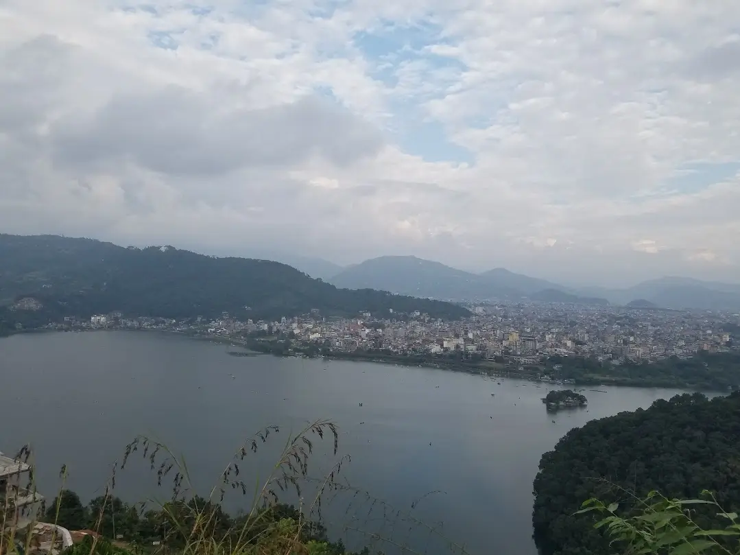
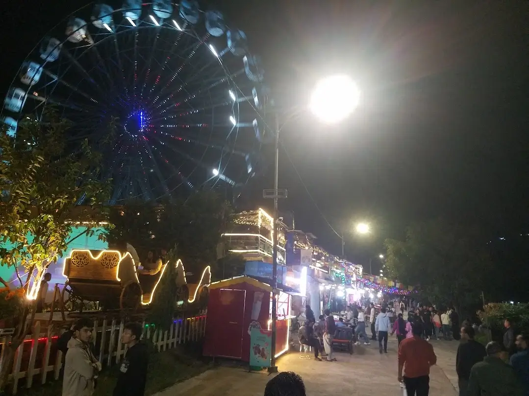
Pokhara is the 2nd largest city and way more laid back than the capital. Trekkers drift in from all over, waiting for weather or clarity. The lake mirrors the peaks, and the lakeside boardwalk offers a vibrant nightlife area free from motor traffic.

Density of services near the lake is extremely high – expect to find hotels, small local eateries, convenience stores, cafes, barbers, laundry service, pharmacies and random shops all on one city block.

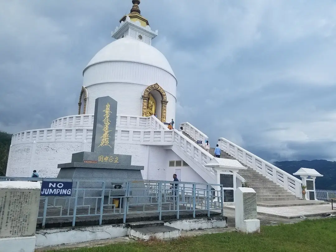
You can spend mornings tracing the shoreline with coffee in hand, afternoons sorting gear or hiking to the world peace pagoda. It’s easy to see why Pokhara is the tourist and expat hub of Nepal.

Layout & Vibe

Lakeside is the main zone – part resort strip, part traveler hub. Everything’s here: cafes, guesthouses, trekking shops, bakeries, noise or chill depending which alley you decide to walk down.

Moving between zones is easy on foot or by scooter rental. Pokhara feels efficient once you’ve learned its shortcuts.

view of entire pokhara lakeside disneyland in pokhara phew lake

Nomads and Expats

Wi-Fi is solid in most hotels and cafes now, however power cuts are still frequent. Backup solar setups are common in midrange guesthouses. The pace suits remote work – slow mornings, relaxed lunches, no hustle.

Cafes line almost every street close to the lake. Fresh baked goods and coffee starting from under 100NPR. For quiet work, Lakeside North and Pame beat the main drag.

Food:

Dal bhat fuels the locals here. The local saying goes "dalbat power, 24 hour!". Local dalbat (or khana) sets are a great value for 200 for veg to 400NPR for chicken – endless rice refills, lentils, curry, greens, pickle. Local and Tibetan spots serve hearty momos and thukpa (noodle soup). Western cafes have caught up too: real espresso, smoothies, pastries, even vegan joints.

Accommodation:

Budget rooms run 600–1500 NPR per night. Monthly rates drop if you stay put – especially during monsoon or shoulder months. For longer stays, the area just outside of Lakeside offers peace and easy access to trails. Some digital nomads rent small apartments near the lake for 25k-45k NPR per month with a kitchen.

Adventures & Recovery

  • Paragliding off Sarangkot – 20 min of air with snow cap mountains as backdrop.
  • Ultralight flights or microlights for surreal aerial views.
  • Boat rides in Phewa lake, solo or assisted.
  • Day hikes to World Peace Pagoda or across the ridge to Dhampus.
world peace pagoda in pokhara nepal big buddhist statue near pagoda

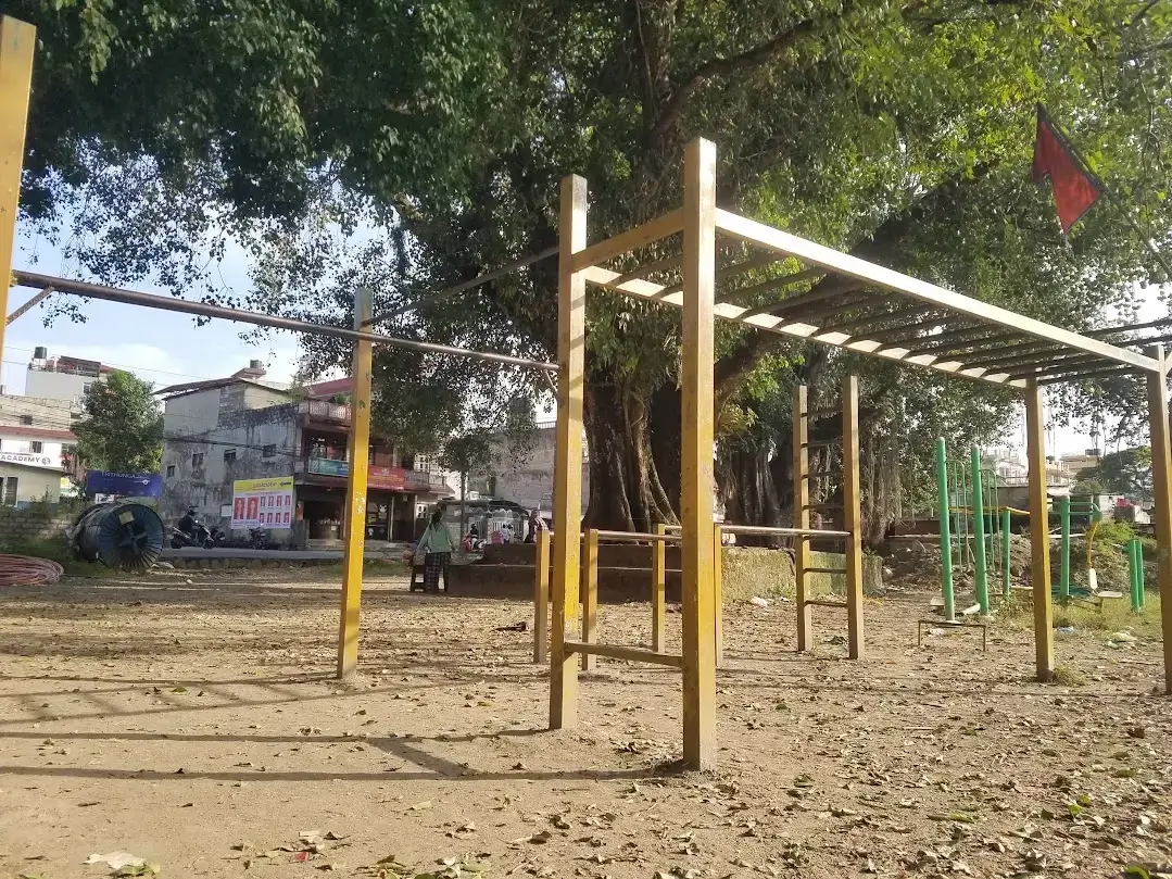
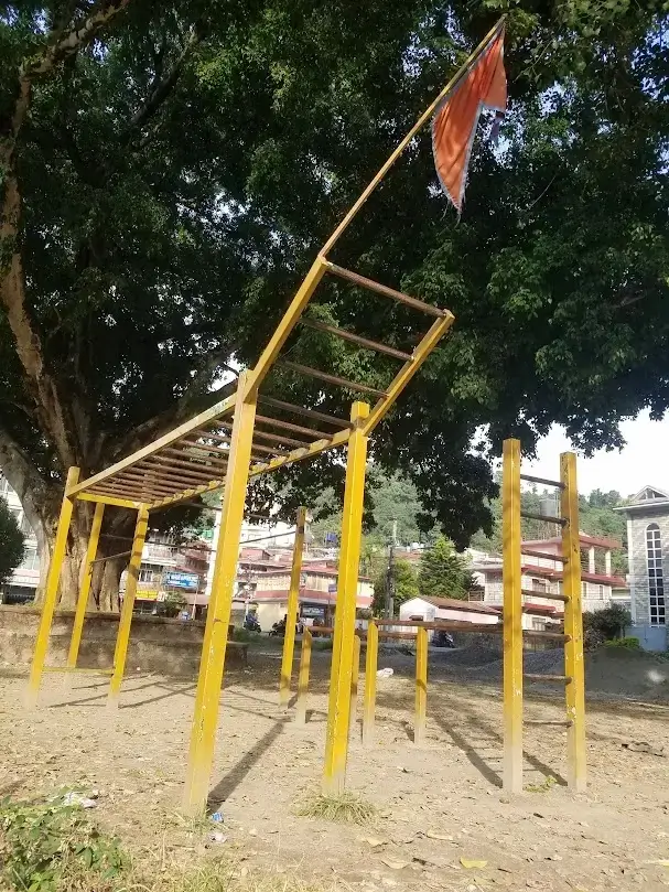
Ghost Mode Training Spot

  • Cow Park located on the main avenue and close to the lake offer an extensive calistheics setup - Monkey bars, high bars, parallel bar and ladders. Perfect for performing muscle-ups, human flags, dips, and handstand on p-bars
  • world peace pagoda in pokhara nepal big buddhist statue near pagoda

    Gateway to Annapurna

    Every trailhead in the Annapurna sanctuary is accessible from here. Permits can be obtained at the ACAP office in Damside. You need to bring your passport and submit a one-page form with 2 photos + 3000 NPR cash. There are a few shops at the ACAP office that can develop 2 photos for only 150 NPR.

    Take cash - don’t expect ATMs in the sanctuary. Food gets more expensive the higher you go. My daily expenses averaged 3450 NPR, which included lodging, meals and occasional tea/snacks.

    Bring water purification tabs to save cash and reduce plastic in the sanctuary. Pharmacies in Pokhara sell boxes of 50 aquatabs for 300 NPR.

    Ghost Trek Overview

    Category Details
    Total Duration 38 days total trekking
    Total Distance ~500–550 km (estimated including side trips)
    Highest Elevation Thorong La Pass – 5410 m
    Major Side Treks Tilicho Lake, Ice Lake, Lamjung BC, Mardi Himal BC, Hidden Lake, Khayer Lake, Poon Hill, Mohare Danda, Kapuche Lake
    Difficulty Mild → Extreme (sustained endurance, technical terrain and repeated high altitudes)
    Permit Annapurna Conservation Area (ACAP) for 3000 NPR
    Season Sept - Oct
    Style Solo & self-supported, no guide or porter
    Base Weight Main Backpack and day pack ~10kg total. No photography or climbing gear.

    With gear, cash and permit sorted, it’s finally time to crush some trails. From gentle village stone paths to sketchy cliffs and waterfall crossings, each day brings new terrain and challenges. Below is the Complete Ghost Circuit - There is no agency that sells or would advise this entire route. Note: Ghost times do not include lunch or long tea breaks.

    Itinerary

    This is the most aggressive and complete Annapurna trekking itinerary online. If you can keep up with this schedule, you are a Ghost.

    Section I

    Day 1: Pokhara → Nayapul → Ghandruk

    Day 2: Ghandruk → Jhinu Danda → Chomrong

    Day 3: Chomrong → Himalaya

    Day 4: Himalaya → Machhapuchhre BC → Annapurna BC

    Day 5: Annapurna BC → Chomrong

    Day 6: Chomrong → Tadapani

    Day 7: Tadapani → Ghorepani

    Day 8: Ghorepani → Sikha

    Day 9: Sikha → Tatopani

    Day 10: Tatopani → Ghasa → Jomsom

    Day 11: Rest / Resupply in Jomsom

    Day 12: Jomsom → Kagbeni

    Day 13: Kagbeni → Jhong → Muktinath

    Day 14: Muktinath → Charabu

    Day 15: Charabu → Thorong La → Phedi → Churi Latar / Yak Kharka

    Day 16: Yak Kharka → Jarsong Bridge → Khangsar

    Day 17: Khangsar → Tilicho BC → Tilicho Lake → Tilicho BC

    Day 18: Tilicho BC → Khangsar → Manang

    Day 19: Rest / Day hikes around Manang (Praken Gomba / Chongkor)

    Day 20: Manang → Braka → Ice Lake → Braka

    Day 21: Braka → Upper Pisang

    Day 22: Upper Pisang → Chame

    Day 23: Chame → Lamjung Base Camp → Chame

    Day 24: Chame → Besisahar (Jeep)

    Day 25: Besisahar → Pokhara (Bus)

    Section II

    Day 26: Pokhara → Kande → Australian Camp → Forest Camp

    Day 27: Forest Camp → High Camp → Mardi Himal BC → High Camp

    Day 28: High Camp → Forest Camp → Landruk

    Day 29: Landruk → Ghandruk → Tadapani

    Day 30: Tadapani → Dobato / Muldai Viewpoint

    Day 31: Dobato → Hidden Lake → Dobato

    Day 32: Dobato → Dhan Kharka → Khopra Ridge

    Day 33: Khopra Ridge → Khayer Lake → Dhan Kharka → Swanta

    Day 34: Swanta → Ghorepani

    Day 35: Ghorepani → Poon Hill → Mohare Danda → Ghorepani

    Day 36: Ghorepani → Tadapani → Jhinu Danda

    Day 37: Jhinu Danda → Samrung → Landruk → Deurali → Australian Camp → Kande → Pokhara

    Section III

    Day 38: Pokhara → Sikles

    Day 39: Sikles → Hugu Goth

    Day 40: Hugu Goth → Kapuche Lake → Sikles

    Day 41: Sikles → Pokhara

    Ultimate Annapurna Ghost Trek

    Section I: Annapurna Base Camp and Thorong La

    Day 1 – Pokhara (820 m) → Nayapul (1070 m) → Ghandruk (1940 m)

    From the Zero Km intersection (Phewa Marga Ave + Baglung highway) in Pokhara. Take a van or bus to Nayapul for 250 NPR. These usually leave every 30min and take around 1hr 45min including lunch to arrive in Nayapul.

    The classic ABC trek starts here - Mostly jeep roads out of Nayapul followed by moderate stone steps up starting from Kly Danda hamlet. Climb gradually through villages and farmland to forested paths near Ghandruk.

    Notes: Easy to moderate uphill intro hike day. Bus logistics in the morning.

    Gate into Gandruk village Animals in Gandruk

    Day 2 – Ghandruk (1940 m) → Jhinu Danda (1750 m) → Chomrong (2170 m)

    Terrain: Some large rolling stone hills. Several stair forks so keep your map handy. Ghost time from Ghandruk to Jinhu village: 2hr 35min. Take a break at Jhinu Danda to soak in the springs. The springs are 200NPR but probably free in the low season - note the path down to the springs from Jhinu is the farthest from the village in all of Annapurna; it’s all the way down by the river. Ghost time of 12min down to the springs from Jinhu village, 20min back from the river.

    Suspension Bridge into Jinhu Danda village Jinhu Danda Hot springs

    Grab a bite in Jinhu village after your soak, then continue up more stone step to a hub village of Chomrong in a ghost time of 55min. Chomrong is where some agency trekkers start if they want a shortcut.

    Lucky Guesthouse in Chomrong has nice double rooms with large patio and dining room for 300 NPR.

    Day 3 – Chomrong (2170 m) → Himalaya (2920 m)

    Terrain: Rocky, narrow trails with some waterfall crossings. Mostly uphill. Pass through the lush forest of Bamboo Village and the 108 waterfalls before the final climb to Himalaya hamlet. This should be easy in the dry season. Ghost time not recorded due to frequent stops from isolated storms.

    path from chromrong to himalaya 108 waterfalls near himalaya

    Day 4 – Himalaya (2920 m) → ABC (4130 m)

    Terrain: Gradually increasing altitude; mix of rocky paths and loose scree near Machhapuchhre Base Camp (MBC 3700 m). Minor landslide risks before MBC with loose rock and several streams. Grab a tea or lunch in MBC before the final push to ABC. Charge your electronics at MBC, since charging at ABC lodges costs 200 NPR extra.

    Ghost time from Himalaya to ABC: 3h 25min. The lodges at ABC are very basic and not cheap, however it’s worth staying here in order to acclimate for the Thorong La push later. If you are not planning to do the full Annapurnca circuit, its better to stay at MBC and just day hike up to ABC.

    snow peaks from annapurna base camp abc sign abc statue abc sign

    Day 5 – ABC (4130 m) → Chomrong (2170 m)

    Terrain: Backtrack to Chomrong, the same way you came but double time. Longer day with a total descent of over 3000 m and net elevation loss of almost 2000 m. Stretch your hips and knees while taking a breather.

    Day 6 – Chomrong (2170 m) → Tadapani (2630 m)

    With the famous ABC trek complete, most people are already heading back to Pokhara. But we're just getting started. The trail forks here and we're taking the route less travelled. Poon Hill trek starts next.

    Climb out of Chomrong on stone steps to a valley path. Forested ridge trails; moderate stone stair climbs. Fewer trekkers on this trail vs the standard ABC path. No other hikers going the same direction at the end of monsoon season in early September.

    trail to tadapani from chomrong valley view out of chomrong small village on the trail

    Panoramic Hotel in Tadapani, 500 NPR for a nice double room near the top of the village. This is one of the few lodges with some real luxury vibes-hot shower, roaring furnace and good service-rare for trekking routes. Tadapani is one of the major hub villages in ACAP. Ghosts can comfortably reach Ghorepani in 1 day in dry weather.

    Day 7 – Tadapani (2630 m) → Ghorepani (2860 m)

    Some downhill and a moderate uphill. More stairs and dirt trail through forest and terrace hills. Moderate rolling stairs across a few waterfalls and creeks. Poon Hill sunrise the next day if it’s clear.

    trail from tadapani to gorepani lodges of gorepani

    Moonlight Guesthouse - smaller cozy place in the center of Gorepani with warm furnace and hot shower. Amazing food and hospitality, rooms for only 200 NPR.

    Day 8 – Ghorepani (2860 m) → Sikha (2100 m)

    Terrain: Mixed forest trail; rolling hills; some steep sections.

    Notes: Easy descent day if you dont get lost. A mix of jeep road, stone stairs and faint trails. On a dry day you can easily head straight to Tatopani.

    Sikha village

    Day 9 – Sikha (2100 m) → Tatopani (1190 m)

    Terrain: Long downhill; mostly stone steps and dirt paths. Connect with the highway towards Jomsom - you’ll need to hike on the Jomsom–Beni highway for 2–3 km until reaching Tatopani. Tatopani literally means hot-springs in Nepali.

    Notes: Soak in Tatopani hot springs for 150 NPR - best equipped hot springs in Annapurna with large shower area and 2 pools. Located right next to the village.

    Stairs down to Tatopani Hot springs in Tatopani

    Day 10 – Tatopani (1190 m) → Jomsom (2710 m) (Jeep/Hike/Bus)

    Terrain: Jeep road that gets washed out or blocked by landslides. Classic trekker route on the other side of the river. Multiple bridges can be accessed via the highway.

    Notes: Jeeps and buses are unreliable, and may be stalled due to landslides. If the bus is stuck, cross one of the many bridges over the Kali Gandaki River to bypass the roadblock.

    Notes: I took a van from Tatopani which got stuck after 10 min due to a landslide. So I crossed the suspension bridge and hiked past the slide, where I caught a chicken bus. It was the end of monsoon season, so that bus got stuck as well. I crossed another suspension bridge and hiked to a small village Ghansa. There were a couple of rustic lodges in the village, so I knew I was safe for the night. I caught a jeep straight to Jomsom for 500 NPR. Total travel time approx 8.5hrs from Tatopani to Jomson.

    landslide traffic landslide on highway bridge across beni highway

    Day 11 – Optional rest/resupply day in Jomsom (2710 m)

    Remote arid mountain town on the northern edge of the sanctuary. Good place to resupply - Jomsom is the last real town until Besisahar. Optional mild uphill hike to the nearby village of Thini (2800 m) through apple orchards.

    jomson sign jomson temple Leopared Cave in Thini

    Riverview Guesthouse has double rooms for 600 NPR and laundry loads for 500 NPR.

    Day 12 – Jomsom (2710 m) → Kagbeni (2810 m)

    Terrain: Gravel and paved jeep road with views of the Kali Gandaki River below; dry, windy, relatively easy and flat. You can hike down to the river if you need more of a challenge.

    Paradise Guesthouse in Kagbeni has nice rooms and large dining room with solid wifi for 500 NPR, by far the cheapest in the village.

    Notes: There was also a chicken bus to Muktinath from Jomsom that stopped running at 9 am if you need a shortcut to Muktinath.

    jomson to kagbeni jomson to kagbeni highway statues Kagbeni village river view in Kagbeni village

    Day 13 – Kagbeni (2810 m) → Muktinath (3760 m)

    Terrain: Don’t hike along the highway. There is an old jeep road north of the highway that runs through Putak and Jhong, small villages 1 hr from Muktinath. Exposed scree jeep road with almost no motor traffic due to the adjacent highway. Mostly uphill; trail can get confusing leading into Muktinath. Ghost time: 3hr 55min from Kagbeni to Ranipauwa, the village beside the temples of Muktinath.

    trail from kagbeni to muktinath putak village flags outside jhong

    Bob Marley hotel has hot showers and nice dining room with good wifi. Free room with food purchase.

    Day 14 – Muktinath (3760 m) → Charabu (4200 m)

    Terrain: Very short all uphill day. Stairs up to the temples of Muktinath, then scree trail the rest of the way. Check out the fire temple on the way.

    Stay at Charabu to acclimate since there are no more lodges higher up. Ghost time: 1hr 35min from Ranipawa to Charabu. There were only 2 or 3 lodges open in this small hamlet so choices are limited. Short day but vital for acclimating.

    temple of muktinath

    Day 15 – Charabu (4200 m) → Thorong La (5410 m) → Yak Kharka (4050 m)

    This is the climax. Push through the Thorong La high pass. All scree uphill trail, steep at times. Other trekkers trained and prepped months for this day, but for you it feels like routine. Celebrate small wins like reaching 5000m with a snickers.

    No agency goes this way, so expect some curiosity from guides and trekkers coming down.

    Ghost time: 4h 10min to the Thorong pass sign from Charabu.

    trail from muktinath to thorongla altitude marker Thorong la close to top Thorong La High pass

    From the peak, descend a couple hours to Phedi (4280 m), ghost time: 1h 50min from Thorong La.

    You can grab lunch in Phedi but lodges here don’t have showers so keep pushing, past the suspension bridge to the hamlet of Churi Latar (3700 m). Mostly downhill single path scree section with nice views of the river and its tributary waterfalls. Ghost time 50min from Phedi to Churi Latar.

    Phedi Village

    Dhading Laxmi Hotel in Churi Latar at the lower end of the village has nice double rooms and a hot shower for only 200 NPR.

    Notes: This was the opposite direction of the conventional circuit. No agency goes this way since its considered risky due to the rapid altitude gain from Muktinath. Bring your A-game and mentally prepare for a 9–10 hr grind.

    Day 16 – Yak Kharka (4050 m) → Khangsar (3710 m)

    Hike about 30min til you reach a junction on the right off the main circuit. Continue down the valley to a suspension bridge with a lone guesthouse. Crowds thin as you move off the main circuit trail. Moderate single path climb after the bridge. It’s easy to miss the fork towards Lake Tilicho so keep your map handy. You end up in Manang village if you miss the semi-discreet junction. Mostly scree paths the whole way with occasional stair sections. Lightly travelled route.

    trail from muktinath to thorongla fork off the main circuit trail Khangsar village

    Maya Hotel in Khangsar has a free room with any food purchase, warm shower and furnace.

    Day 17 – Khangsar (3710 m) → Tilicho Base Camp (4150 m) → Tilicho Lake (4910 m) and back to BC

    Continue further off the main circuit trail towards stunning lake Tilicho. Rocky trails; uphill scree slopes; high-altitude steep terrain - be mindful of the ledge. Almost all uphill. Steep and exposed. This was my favorite side trek due to the stunning landscapes and surreal lake color.

    Ghost time: 3hr 20min to Tilicho Base Camp. Leave your pack and grab lunch at a lodge in Tilicho BC before hiking up to Lake Tilicho in the afternoon. Ghost time from Tilicho BC to Lake Tilicho 1hr 45min.

    One of the more challenging yet visually stunning days if you hike all the way up to the lake.

    trail to lake tilicho trail to lake tilicho animals around lake tilicho bridge to lake tilicho temple near to lake tilicho annapurna range from lake tilicho lake tilicho

    New Norbu Ling Hotel has a hot shower and furnace. Rooms in the 300–800 NPR range for 1 person.

    Day 18 – Tilicho BC (4150 m) → Manang (3540 m)

    With Lake Tilicho ticked off, that’s 4 major treks down. Time to rejoin the main circuit.

    Descend back through Khangsar and continue through some jeep roads and singlepath to the larger village of Manang. This is an older more significant village.

    Thorongla Hotel in Manang has nice double rooms and large dining hall for 300 NPR. Hike up to Praken Gomba or Chongkor for sunset.

    Day 19 – Rest day in Manang (3540 m) with optional day hikes to Praken Gomba / Chongkor

    Terrain:Manang is a larger village so they have more supplies. Good place for a rest day. Mild uphill climbs on either side of town. Good views of the town, river, and waterfalls. Nice to hike around without the pack.

    manang village sign trail out of manang manang prayer flags ruins in manang viewpoint in manang

    Day 20 – Manang (3540 m) → Braka (3670 m) → Ice Lake (4500 m)

    Easy flat walk 2–3 km to next village of Braka. Drop your bags at a lodge in Braka.

    Day hike up to Ice Lake - a light 1000 m elevation gain. Mostly stone step out of the village, then scree slopes leading up to the lake. Some claim this side 'trek' is challenging but it felt like cake. Ghost time: 2hrs 10min up, 80 min walk jog down without the pack.

    view of ice lake view of ice lake braka

    Day 21 – Braka (3670 m) → Upper Pisang (3200 m)

    Terrain: Easy and smooth downhill along the river and jeep trail. Try to stick closer to the river to avoid the jeep road. Very mild uphills. The trekking route is mostly intact but gets cut by jeep roads at various points.

    bridge to pisang village trail to pisang

    Day 22 – Upper Pisang (3200 m) → Chame (2710 m)

    Similar to yesterday, but jeep roads become more frequent. Easy 2 hr hike along the river mostly downhill. New Tibet Hotel has a free room right next to the springs. These springs are the hottest in Annapurna and are free - only a 1-minute walk from New Tibet Hotel. Easily the favorite hot springs in Annapurna.

    farmhouse lodge between pisang and manang

    Day 23 – Chame (2710 m) → Lamjung Base Camp (3370 m) and back

    This is the only major day hike not visible on OSM offline maps. Moderate hike up to LBC starting from Chame hospital area - mostly well-defined switchback and ridge trails with no other hikers. The trail opens to a grassy area and gets faint near the top.

    Notes: I got lost on descent due to no trail on the map - had to climb down a grassy cliff and scramble hard through dense foliage. Grabbed shrubs and branches for balance trying to descend through thick bush. Scrambled on a narrow dirt path beside sheer rock cliff. Had to climb back up due to sheer rock cliff dead end. Intense and abit dangerous. Luckily found a way out of the woods at 6 pm sunset #blairwitchday. Can’t in good conscience recommend this day hike without adequate map trail data.

    Ghost Time: 3h 15min ascent at a relaxed pace to LBC. Disastrous descent took over 5 hours. Clouds roll in in late morning to afternoon making the trail easy to miss. - drop position pins along the way if your map doesn’t show a trail.

    route to lamjung bc Lamjung yak lamjung lbc base camp
    Soak in the Chame springs again to celebrate your survival.

    Day 24 – Transition: Chame (2710 m) → Besisahar (760 m) (Jeep)

    Congrats, you completed the Annapurna Circuit in reverse along with major side treks Tilicho, Ice Lake and Lamjung - giving you some serious bragging rights. Jeeps leave from Chame every couple of hours. The most expensive ride of the excursion at 2,500 NPR. Road back to civilization is rough and unpaved, moderate traffic.

    Jeep stops a couple times at ACAP checkpoints so have your permit handy. Ride time approx 4 hrs including lunch. Motion sickness alert. Try to leave after rain so the road is less dusty.

    Stay a night at Besisahar for some cheap food and supplies before heading back to Pokhara.

    Day 25 – Besisahar (760 m) → Pokhara (820 m) (Bus)

    Easy to catch a local chicken bus on the main street. Try to negotiate to 600 NPR. Expect the local bus to stop often. Bus time approx 5 hrs including a food stop.

    **Rest and resupply in Pokhara a few days til you’re ready to continue.

    Section II: Mardi Himal, Hidden Lake, Khayer Lake and Mohare Danda

    Day 26 – Revival: Pokhara (820 m) → Kande (1450 m) → Australian Camp (1920 m) → Forest Camp (2160 m)

    From the Zero Km intersection, take a bus or van to Kande for only 150 NPR. The van or bus takes about 1hr 20min to reach Kande. Signs pointing to trailhead are easy to spot at the side of the highway. Stone stairs right away unlike starting in Nayapul. Ghost time from Kande to Australian Camp: 40 min. Australian Camp to Forest Camp: 3 hr 50 min.

    Terrain: Standard stone steps uphill. Well-defined, forested, shaded trails, with some stair junctions. Zero motor traffic.

    trail from landruk to australian camp

    Day 27 – Forest Camp (2160 m) → High Camp (2580 m) → Mardi Himal BC (3560 m)

    Longer and more aggressive day. Hike from Forest Camp to High Camp. Drop your pack and grab some lunch at a lodge in High Camp. Hike up to MH BC in the afternoon when there are almost no other trekkers. Visibility may be limited at this time.

    Ghost time: 1 hr 55 min from Forest Camp to High Camp. 3 hr 5 min from High Camp to Mardi Himal BC. Descend back to High Camp for the night. Congrats, you completed a 5-day agency trek in 2 days.

    Terrain: Mostly stone steps. Some steep rocky and loose trails; exposed ridge. Some smaller paths branching off main route. Stone steps become less frequent the higher you climb.

    mardi himal trail from high camp monument at mardi himal mardi himal base camp

    Day 28 – High Camp (2580 m) → Landruk (1340 m)

    Descend back the same way to Forest Camp, then branch off towards the deep canyon river towards Landruk + Ghandruk and the ABC trail. Long downhill stairs; mild cardio with repeated long stair descent to the lower elevation village of Landruk just before the big river. Easy on cardio, tough on joints. Do some stretching and mobility during breaks.

    stairs down from mardi high camp

    Day 29 – Landruk (1340 m) → Ghandruk (1940 m) → Tadapani (2630 m)

    Terrain: Forest trails easy descent to bridge across the big river. Then moderate climb out of the valley. Cut through 1 jeep road before ascending up steps to the familiar village Gandruk. Take a short break in Gandruk before climbing more steps to your 2nd visit of Tadapani. Tadapani is a trail hub village, so every building is a guesthouse or hotel. Panoramic Hotel sticks out.

    landruk village Tadapani viewpoint

    Day 30 – Tadapani (2630 m) → Dobato (3350 m)/ Mulde Viewpoint (3630 m)

    The correct trailhead towards Dobato is next to Panoramic Hotel. Mostly rolling with mild ascending dirt paths. A mild-moderate scenic windy cliff-valley hike.

    Lucky Hotel in Dobato has hot showers, free wifi, and hot furnace at night - all for 300 NPR for 1 guest.

    Visit the Muldai Viewpoint with 360° panoramic view after dropping your bag in Dobato.

    mulde horse Mulde panoramic viewpoint

    Stay in Dobato for 2 nights so you can hike to Hidden Lake tomorrow. Note: Dobato feels significantly colder than Tadapani.

    Day 31 – Dobato (3350 m) → Hidden Lake (4380 m) and back

    One of the toughest day hikes. Total ascent over 1,300 m over rough, loose rocky terrain and wet waterfall sections. The trail becomes faint after the lone lodge in Pode Kharka, a good place to grab lunch. Easy to get lost in the fog close to the lake. Thats why its called hidden lake. Try to stay close to the trail on the map. Ghost time: 4 hrs up + 3 hrs down.

    Toughest side hike on the route so only carry what you need for the day.

    dobato to hidden lake hidden lake trail trail to hidden lake hidden lake caims hidden lake

    Day 32 – Dobato (3350 m) → Khopra Ridge (3660 m)

    Rolling dirt single path and more scenic snow cap views. Cross several bridges over forested waterfall creeks. Grab lunch in Dhan Kharka (3350 m) before the short but steep climb of about 700 m to Khopra Ridge. There is only one community lodge, so it’s basic - no shower or working furnace in the dining room. This is your base for Khayer Lake tomorrow.

    Note: Khopra felt the coldest place I slept at night - even colder than ABC or Charabu, despite being at a lower elevation.

    trail from dobato to khopra danda khopra waterfall crossing khopra danda ridge

    Day 33 – Khopra Ridge (3660 m) → Khayer Lake (4600 m) → Swanta (2250 m)

    Longer aggressive day. Get an early start to the lake so you can descend back in time for checkout since the lone community lodge doesn’t have shower or furnace. Mostly uphill stairs and scree with some stream crossings. A well defined trail for a more remote route. Reach the sacred Khayer Lake in a ghost time of 3hrs 10min. Decent back to the lodge in a ghost time of 1hr 50min. After checking out, descend to Dhan Kharka for a quick lunch or snack before taking a new connecting trail towards Swanta. Descend through a lush valley with multiple waterfall crossings to reach the picturesque village of Swanta in a ghost time of 3hrs 5min.

    khopra danda khopra ridge trail to khayer lake

    Aggressive day with early lake push and total descent of almost 3,000 m from Khayer to Swanta. Good for noting differences in terrain and temperature across elevations.

    swanta center swanta village swanta mountain view

    Day 34 – Swanta (2250 m) → Ghorepani (2860 m)

    Easy to moderate uphill mostly stone steps with a few km of jeep road. Ghost time 1hr 55min. The 2nd visit to Gorepani where every building is a lodge, so it’s easy to find a room. Prices range from 200–1,500 NPR.

    Poon hill tower Poon hill viewing platform

    Day 35 – Rest day hike around Ghorepani (2860 m) → Poon Hill / Mohare Danda (3310 m)

    Ghorepani has some descent trail loops good enough for a day of hiking without your pack. Head up to Poon Hill again for some pushups and handstand work by the watchtower. Then take connecting trail south towards Mohara Danda. There is a hill with national flags and panoramic view just past the Mohare Danda Viewpoint. Easy, relaxed day with no pack carrying.

    mohare danda viewpoint

    Day 36 – Ghorepani (2860 m) → Tadapani (2630 m) → Jhinu Danda (1750 m)

    Ghorepani and Tadapani are the major hubs, villages where you can access different trailheads in various directions. The route between them was packed in October high season.

    trail between gorepani and tadapani
    Overtake over 100 other guided trekkers/groups and porters like you’re at a outdoors wax museum to reach Tadapani in a ghost time of 2 hrs 15 min. Grab tea or lunch in Tadapani, then take the small trail down towards Melache - a descending dirt path with no stone steps, a nice contrast to the morning with no other hikers. Day of descent allows for more time at the springs. Trail packed between Ghorepani and Tadapani. Trail between Tadapani and Jhinu Danda was empty, rough and faint in places, so stick to the map. Ghost time: 3 hrs 30 min from Tadapani to Jinhu village. Longer downhill day with mix of busy stone trails and solo dirt path. Soak at the Jinhu springs again after a long journey.

    Gorepani center court

    Day 37 – Return: Jhinu (1750 m) → via Samrung / Landruk / Australian Camp → Pokhara (820 m)

    The trail splits after the suspension bridge out of Jhinu. The main trails head toward Chomrong and Gandruk, but we're taking the small trail downhill on the right, right after the Jinhu suspension bridge. This small trail empties out at Samrung. Typical dirt singlepath along the river. Cross another suspension bridge at New Bridge hamlet and take a short hike along a jeep road, luckily with light traffic. Steps cut up through Landruk then Tolka to Deurali. Backtrack to Australian Camp and Kande on the highway. Catch the bus back to Pokhara for 150 NPR.

    samrung under jinhu bridge new bridge annapurna Festival in Pokhara

    Section III: Sikles and Kapuche Lake

    Day 38 - Pokhara (820 m) → Sikles (1980 m) (Bus)

    Sikles is a large Gurung village in a more remote section of Annapurna sanctuary. Its in the opposite side of Pokhara versus the main trailheads (ABC / Mardi Himal / Poon). Not easily reachable, budget an entire day to get there from Pokhara. Urban trek from your hotel to the Khaun Khola bus park located in the NE part of the city. Ghost time: 1hr 10min from Lake Phewa. Catch a local chicken bus to Sikles for 400 NPR at khaun khola station. The road starts paved but quickly turns to muddy/dirt potholes as you get off the main highway. The bus ride is quite thrilling with a rough bumpy roads right next to a grass cliff. Risk of death by landslide is present. Total ride time 4hrs including a long food stop. Lodges in Sikles operate on a package format - usually one price for your room and 2 meals. Package deals range from 1200 - 2000 NPR, less flexible but slightly cheaper than the main trekking routes.
    houses in Sikles Sikles Village

    Day 39- Sikles (1980 m) → Hugu Goth (2020 m)

    The trail up to Kapuche lake is steep and technical in parts. This trek is off the beaten path, there were zero other trekkers going up in late October. Probably the most technically challenging trek in the sanctuary - not suitable for novice or unconfident trekkers. Terrain: Start out of Sikles on a jeep road with no traffic, leading into regular dirt path trail and irregular stone steps. Loose rocks on steep sections and waterfall crossings are common make this one of the most challenging day sections. There is a steep stream crossing that can potentially weed out non-ghost hikers. Ghost time: 2hr 55min to Hugu. Warning, there are only 3 rustic lodges in Hugu and none have shower or WiFi.
    bridge between sikles and hugu

    Day 40 - Hugu Goth (2020 m) → Kapuche Lake (2540 m) → Sikles (1980 m)

    Longer trekking day but nothing you're not used to. Push to the lake in the morning before the clouds obscure views around 10-11am. Ghost time: 1 hr 0min to Lake Kapuche from Hugu. This is billed as a 4 day trek, but you just crushed it in 2 days easy, with ample time to explore the connecting trail to Kori Peak. Terrain: irregular stairs, scree, very steep steps and stream crossings in certain sections that can potentially cause other trekkers to turn back.
    Lodge at Kapuche lake Kapuche Lake
    Descent back to Hugu for breakfast and checkout. Backtrack to Sikles for the night. Note: There was a bridge after Hugu heading towards Kori Peak that I haven't explored yet. This adjacent path is even more off-beat than the Kapuche Lake trail. Regular stairs climb out of Hugu. I didn't push through this section since my 90 days visa was expiring.

    From scree to streets

    Back in Pokhara, the chaos clashes with the stillness of the trails, but your legs still move to the rhythm of the ridges. The paths are behind you, yet the flow never leaves.

    ← Back to Destinations